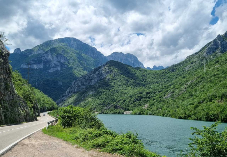
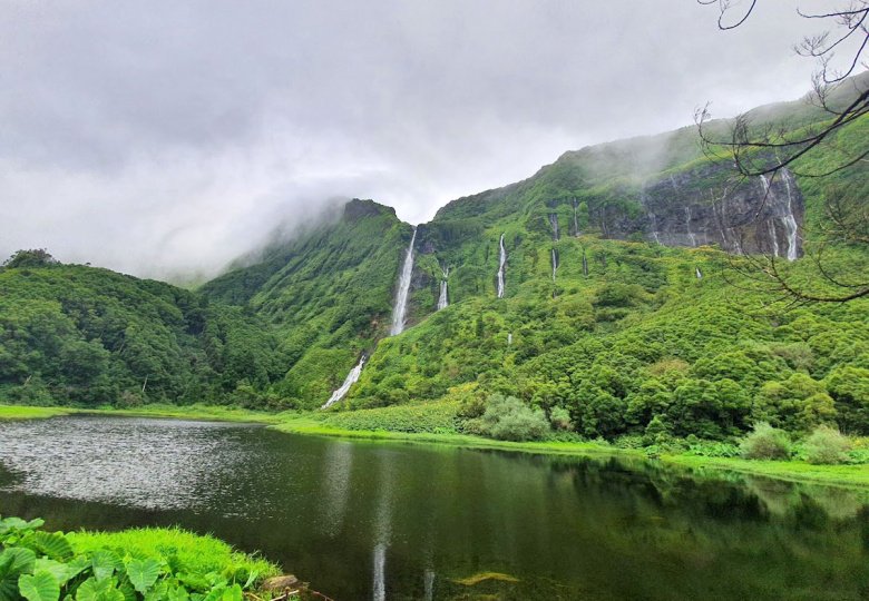
There’s no better way to explore Wales than on two wheels. This cross-country bike tour across Wales covers stunning hidden gems like the Elan Valley, Llanthony Pass, Snowdonia, and the Welsh coast — all in as little as 4 days. Whether you’re an experienced road cyclist or a light touring bike packer, this Wales cycling route offers dramatic landscapes, quiet country roads, and unique towns like Harlech and Llanfairpwllgwyngyllgogerychwyrndrobwllllantysiliogogogoch.
In this guide, I share the full itinerary, distance, elevation, route tips, and insider advice to help you plan your ultimate Wales bike tour.
Wales Tour Highlights
- Wye Valley AONB
- Elan Valley and its 6 dams
- Gospel Pass and the Black Mountains
- Barmouth Beach
- Europe’s steepest road at Harlech
- Snowdonia mountains
- Anglesey and Europe’s longest place name
Wales Bike Tour Route: 400km Across the Country
Total distance: 405km (252 miles)
Total elevation: 4,920m (16,000ft)
Starting from the English border, at times the route follows the Lon Las Cymru (National Cycling Route 8), veering off it towards places I felt more interesting or easier on a road bike.

How Long Does a Wales Bike Tour Take?
Took me 4 days on a light bikepacking tour set up with road bike averaging 100km/day, some of which turned out quite climby and longer than expected. So up to you how easy you want to take it – it can easily be a more relaxing 1 week trip!
There is plenty of accommodation as well as camping options on the way depending on the distance you prefer to cover.
Best Time to Cycle Across Wales
Wales is best tackled from late April to late September to enjoy more daylight and maybe – with a little luck – warmth and sunshine. As with the rest of UK, you’re likely to encounter some rain whatever the season and Wales tends to be even more wet so prepare accordingly.
Wales Cycling Route Difficulty & Elevation
The route contains a bit of everything: River valley flats, rolling hills and a few mountain passes thrown in. They rarely get ridiculously steep if you stay on route, but certain wilder stages in Mid-Wales are definitely on the challenging side. So be prepared for plenty of climbing and set up your gears accordingly.
Traffic-wise, much of the cross-Wales bike route is very light on car traffic. There are a few busier sections, but nothing dangerous. Roads are mostly tarmac in good condition, with a couple gravel stretches. Do watch out for the occasional caravan on some of the narrow road mountain passes.
Where to Start Your Wales Bike Tour
I recommend starting in England for a more dramatic entrance into Wales over the impressive Severn Bridge, but it’s up to you. A convenient start option would be Bristol for the train links, although if you also want to enjoy a little Cotswolds as an aperitif you could start in Chippenham. Severn Beach or Pilning are the closest local stations to Severn Bridge.

Wherever you choose to start and end, if you’re taking the train you’ll likely be using Great Western Railway. GWR have one of the stingiest bike policies, so be sure to book well ahead for the 4 or so tiny closet spaces they have on their trains. And ask at the platform where the bike carriages are.
Part 1: Wye Valley Bike Tour (Scenic Start to Wales)
Once off the Severn Bridge, it’s only a short hop past or through Chepstow (with its riverbank castle) before you join the A466 road tracing the river Wye through the picturesque valley. It’s a gentle, fairly flat introduction to Wales along the river that separates the country from England. That means just about any bridge you cross, you also cross the border.

The 12th century Tintern Abbey was my first proper stop in Wales and one I’d recommend spending some time in. The tranquil ruins are located in a stunning setting by the river Wye and there’s a decent range of cafes to refuel.

Heading up North along the meandering Wye, I reached the wealthy market town of Monmouth with its beautiful Monnow Bridge over the river that pours into Wye. Topped up on fish & chips, I change direction to make my way west towards the edge of Brecon Beacons where I’d be staying the night.
The terrain on the way is very forgiving right up until I reach the threatening hills that mark the edge of Brecon Beacons. At this point, the smarter thing to do was find somewhere to stay in Abergavenny (no extra hills to climb). Of course, I rarely choose the easy option, instead planning myself into completely avoidable leg burn by choosing the former mining town of Blaenavon in the next valley, across the menacing hills.
The surprising and painful revelation about many Welsh climbs is that they without doubt feel tougher to conquer than the much longer Alpine mountains passes. Sure, the peaks of the Dolomites might be a long, slow grind, but they twist into forgiving serpentines and rarely get ridiculously steep. Meanwhile the road to Blaenavon doesn’t mess about – straight up the hill we go! The reward is a completely different scene to earlier in the day – rugged, open and tree-less views more reminiscent of the Scottish Highlands.
Part 2: Black Mountains to Rhayader

I start with another climb to get back towards Abergavenny. It’s again on the steep side, but the gorgeous views up at Keeper’s Pond (once created for mining) are a just compensation. Despite the chilly September winds, I even observed a brave soul going for a short-lived swim while starting to shiver in my jacket.
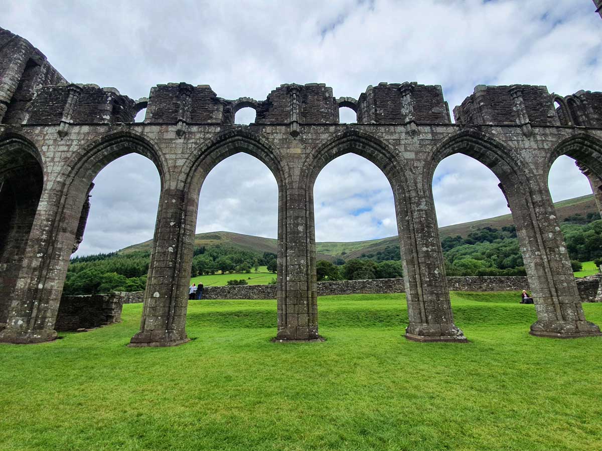
Down and past Abergavenny you get into some classic Welsh countryside with some short ups and downs before embarking on the highlight of the day: Llanthony Pass. It’s a mostly gentle but long ascent up a cosy, increasingly picturesque and almost traffic-free country road. Around a ⅓ of the way up is another religious ruin in a breath-taking backdrop – this time Llanthony Abbey. This once great priory has its own café and given the views and what’s to come, it’s a perfect lunch stopover.
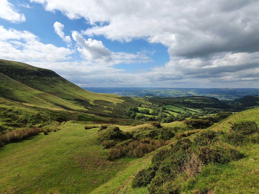
From Llanthony, the climb continued and steepened as I neared the summit of Gospel Pass. It wasn’t long before I realised I’m on one of the most jaw-droppingly beautiful roads in UK. And Wales’s highest paved road at that. With the epic views of the wild horses, Black Mountains to the left and England just to the right, it was the highlight of the tour so far. One of the hills is lovingly named Lord Hereford’s Knob. Once you’ve soaked in the scenery, enjoy the descent down to Hay-on-Wye – just wow! Just watch out for the odd boomer campervan and get your jacket ready.
The rest of the day’s route is a very subtly ascending slog through fields & forests towards the town of Rhayader. More traffic on this section and while still pretty, Gospel Pass raised the scenery bar really high by this point.
At last I reached Rhayader with a couple hours of daylight to spare. The quite lively town on River Wye is known as a base for local outdoor activities and has plenty of accommodation. All that was left is to choose which of its many pubs tempted me the most.

Part 3: Elan Valley to the Welsh Coast

The longest day of the Wales bike tour from Rhayader to the coast began with one of the highlights of the entire 4 days. A detour via the hidden gem of Mid-Wales – the Elan Valley.
The 6 dams of Elan Valley are stunning feats of Victorian-age engineering that are sights to behold in their own right. They form the scenery here, shaping out vast reservoirs stretching along the valley, used for providing fresh water to Birmingham. It’s very serene and sparsely visited, with near traffic-free roads, probably thanks to the relative remoteness of the area.


The very enjoyable road (that’s in a good condition) continues up towards the upper valley past the most impressive of them all, Craig Goch Dam with its aqueduct-like top. Embracing the views here, I continued along the reservoir to Elan Bridge where the road turns into a decent mountain climb before turning back down to Rhayader.
From there, classic Welsh countryside ensues as I rejoin the official Lon Las Cymru cycling route: valleys, forests, sheep, cute villages, hills, more sheep. A lunch stop in the valley town of Llanidloes proves a sensible move, with the next section both a calorie-burner and pure wilderness. The gradual climb on B4518 out of the town takes you past a through an impressive pine forest on empty roads before turning up the gradient for the final 200m climb.
Reaching today’s highest point of just over 500m, the views of the road stretching along the hills ahead are unforgettable. Then one hell of a descent ensues all the way to Machynlleth at near sea level. It’s an interesting, somewhat bohemian market town – surprisingly home to the Welsh Museum of Modern Arts as well as a Centre of Alternative Technology (20% discount for cyclists). For those taking it easier on the daily mileages, Machynlleth makes for a great overnight stay.

I was set to reach the coast and pushed on, frustratingly wasting 45 mins of legs with a wrong turn out of Machynlleth. Finally back on track, 2 more substantial climbs awaited (at least that’s how they felt by this point), the second a scenic valley pass through to Dolgellau. From there, it’s a welcome flat mainly on gravel along the official cycling route. The road follows the mouth of river Afon Mawddach before finally reaching the sea at Barmouth!

The seaside down can be proud of wide, sandy beaches and is something you shouldn’t miss arriving here in welcoming weather. I crossed a wooden toll bridge over Barmouth Bay asking passers to “pay the troll”, so keep some small change handy for what looked like an honesty box. With the sun setting over the Irish Sea, I once again had to push on to Harlech for another 20km before complete darkness.

Part 4: Snowdonia to Llanfairpwllgwyngyllgogerychwyrndrobwllllantysiliogogogoch
The bikepacking tour finale heading out of Harlech proved a day of peculiar places and the very worst of British weather. Visiting Harlech, you can’t miss the Castle at the top. Whereas it once stood on a sea cliff, the flat ground below gradually surfaced as it rose and newer parts of Harlech spread along the new plain. Connecting the two are a handful of steep roads, the most ridiculous of which, Ffordd Pen Llech, has gone down in the Guinness World Records as the steepest street in the world. It’s been battling it out for the record with Dunedin in New Zealand and appears to have since lost the title.
Either way, it’s still a bastard to even walk up, with gradients of up to 37.5%! Naively, I attempted Ffordd Pen Llech on my bike in torrential rain with all the touring gear and raw legs from yesterday’s big ride. I completely lost momentum in the first 10 meters and duly pushed the bike up by foot.


A very wet & tailwindy morning continued through the mostly flat route up until the picturesque bridge over Afon Glaslyn. It was the last chance of a decent snack before the real Snowdonia began. From here you have 2 equally great options to get to Bangor on the other side, all mountain passes taking you through majestic views of Snowdon and its sister peaks.
With the low clouds and the relentless rain in mind, I chose the slightly shorter way A4085 having originally planned the parallel A4086 based on Strava heatmaps. It’s the biggest climb of the day but at only 200m and with reasonable gradients, nothing too challenging for tour-adjusted legs. At the top of the pass is another panoramic reservoir, Llyn Cwellyn, and what I could only imagine would have been impressive views of the mountains on either side. Alas, that’s something I had to leave to imagination as the endless blanket of low clouds showed no sign of easing.

The tailwind-fueled descent towards Bangor literally felt like a breeze. The bike tour concludes on the island of Anglesey, once the last stronghold of the Druids. You could head all the way to Holyhead, its main town at the Northwest end which probably makes for the most sensible final destination with train connections back to mainland. Instead, I chose to end in lovingly-named Llanfairpwllgwyngyllgogerychwyrndrobwllllantysiliogogogoch. At 58 characters, it’s the longest place name in Europe (take that, Germany!) and 2nd longest in the whole world. I sense it’s a gimmicky trick to attract tourism – locals don’t say the full name – and it certainly worked. To be honest, there isn’t much to do here other than taking a photo with one of the signs and getting a souvenir from the visitor centre.

As the rain finally cleared as if to mock me, I made my way back to Bangor for a well-earned pint and burger before the train back to London. If you want to continue your Wales bike tour from here, head on east towards Chester. The views from the train across the North Welsh coast were just as impressive, as is Chester itself, and I’ve already ear-marked northern Wales for a new cycling tour.
Got questions about the route or suggestions for better cross-Wales cycling itinerary and routes? Feel free to leave them in the comments below.
For more cycling holiday inspiration, read my guide to the 14 Best Hidden Gem Cycling Destinations Around the World.
Found this cycling guide useful? You can support the site with a coffee ☕ — it helps cover hosting costs.